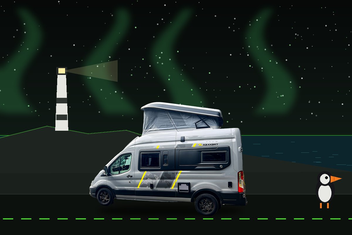
01 / MISSION PROFILE
The gentle way to do the far north is to stop doing it in a hurry.
The NC500's north loop punishes vans that treat it as a lap and rewards the ones that pitch for two nights and walk. Three two-night bases beyond the Great Glen, bracketed by honest transit days — and where Expedition 01 turned for Skye, this file keeps going north. Route planned, not yet driven — this file will gain field notes after the wheels turn.
DEMAND
EXPEDITIONThe archive at full stretch: distance, boats and weather all at once. · 1300–1500 miles.
WORCESTERSHIREULLAPOOLDURNESSDUNNET HEADSPEYSIDEHOME
02 / JOURNEY LOG
Ten days. Up the middle, along the top, home down the east.
Two positioning days to Loch Broom, then the crown of the route: Assynt, Durness and the north coast road to Dunnet Head, with Culloden and Speyside breaking the run home.
Worcestershire → Strathclyde
The first positioning leg: M6 and M74 to the country-park pitch outside Motherwell — motorhome services on site, nature trails a ten-minute walk. An unglamorous, perfect halt.
NIGHT 1 / STRATHCLYDE COUNTRY PARK C&MCStrathclyde → Loch Broom
North past Stirling, over Drumochter on the A9, then west on the A835 to a waterfront pitch at Ardmair, minutes north of Ullapool with Isle Martin across the bay. Evening fish and chips on Ullapool's harbour front.
NIGHTS 2–3 / ARDMAIR POINT, ULLAPOOLAssynt loop
The oldest landscape in Britain on the A837: Knockan Crag's geology trail (free), Ardvreck Castle's ruin on Loch Assynt's shore, and Suilven and Canisp rearing off the moor. Leave Achmelvich's lane to smaller vans — the main-road views don't shortchange anyone.
BASE / ARDMAIR POINT, ULLAPOOLUllapool → Durness
The A835 and A838 through Scourie and past Handa's sound — single-track country begins in earnest — to the clifftop pitch above Sango Bay, with Durness village and the restaurant next door.
NIGHTS 4–5 / SANGO SANDS, DURNESSDurness day
Smoo Cave's walk-in chambers (the inner boat trip runs seasonally, fees), Balnakeil's craft village and hot chocolate, Faraid Head's dunes. Cape Wrath is a foot-passenger expedition — the tiny Kyle ferry plus minibus when running, MOD range permitting — so the Landship waits at Keoldale. Check locally.
BASE / SANGO SANDS, DURNESSThe north coast road
The emptiest A-road in Britain: Ceannabeinne's beach, Loch Eriboll's long arm, the Kyle of Tongue causeway under Ben Loyal, Bettyhill and Strathnaver's clearance country — to the dunes behind Dunnet Sands.
NIGHTS 6–7 / DUNNET BAY C&MCThe true top, at whatever pace
Fair: Dunnet Head's lighthouse cliffs — the mainland's real most-northerly point, whatever John o' Groats says — and the Duncansby stacks walk from the lighthouse. Foul: Castle of Mey's late Queen Mother's rooms (seasonal, fees) and the o' Groats signpost for the record.
BASE / DUNNET BAY C&MCCaithness → Speyside
South down the A9's cliff-edge Berriedale Braes — engineered easier now, still respect it — with the Whaligoe Steps option, then Culloden's moor (NTS, the reciprocal card's moment) before a Spey-side pitch at Grantown.
NIGHT 8 / GRANTOWN-ON-SPEY CARAVAN PARKSpeyside → Strathclyde
Over Drumochter southbound with a House of Bruar leg-stretch, back to the known country-park halt. Last night under way — tally the field notes while they're fresh.
NIGHT 9 / STRATHCLYDE COUNTRY PARK C&MCStrathclyde → home
M74 and M6 south. Unpack, weigh the lessons, file the field notes — and with them, the first ring closes: Skye to the Suffolk shore, the Causeway to Cape Wrath's doorstep.
HOME / WORCESTERSHIRE03 / OPERATIONS BRIEFING
The details that keep the adventure easy.
Treat the three two-night bases as the fixed centre. Up here the operational discipline isn't tides or ferries — it's fuel, water and the single-track code.
PRIMARY DISCIPLINERANGE COMMAND
ULLSPARSE PUMPS / CARD-OPERATEDTHU
Fuel, water, empty tanks
Between Ullapool and Thurso the map goes quiet: brim the tank at both ends and treat the small community pumps between — often unstaffed and card-operated — as precious top-ups, not plans. Never run the margin thin against a headwind. The same doctrine covers the habitation systems: take on fresh water and empty waste and cassette at every serviced opportunity, because the next point may be two bases away. LPG is rarer still — arrive north with bottles full.
BOOKING SEQUENCE
- 01Sango Sands, DurnessBook the electric pitches — the clifftop fills first.
- 02Dunnet Bay C&MCSeasonal site — confirm opening for shoulder months.
- 03Ardmair Point, UllapoolThe waterfront pair. Broomfield's seafront in town is the first-come alternative — no advance bookings for single units.
- 04The bookendsStrathclyde ×2 and the Grantown Spey-side night.
- 05Local checksSmoo boat season, Cape Wrath ferry status, Castle of Mey opening.
VEHICLE PROFILE
5.98M LENGTH
2.98M HEIGHT
2.11M WIDTH
Six metres is the honest ceiling for relaxed far-north touring — the A-road spine carries it easily; the side-lanes are where judgement earns its keep.
CREW RHYTHM
One major objective per half-day.
The transits bracket the trip so the crown days stay slow. Day 7 carries the flex inside it — the top of the map at whatever pace the weather and the crew allow.
ROUTE CAUTIONSingle-track is the default up here, not the exception — and passing places are for passing, not parking.
Pull in early on your own side, let following traffic by as readily as oncoming, thank with a lift of the hand, and never occupy a passing place for a photograph. The road works because everyone honours the code.
04 / UK ACCESS STACK
The same wallet, at the top of the map.
Scottish rules from Expedition 01 still apply — Historic Environment Scotland and NTS in place of the English cards, with the reciprocal terms doing the travelling. Up here the honest story is emptiness: the stack thins as the land does. Carry physical cards; admission, booking and parking rules vary by organisation and property.
Culloden carries the cards
The NT card opens NTS doors — Culloden's battlefield centre on day 8 is the route's set-piece use — while HES honours the EH reciprocal: half-price in year one, free after the first renewal. North of Inverness both estates run thin; that's the terrain talking, not the cards.
The far north's best is free
Knockan Crag's geology trail, Ardvreck's clan ruin, Ceannabeinne, Faraid Head, Dunnet Head's clifftop and the Duncansby stacks — the crown jewels up here cost nothing but weather-sense and boot leather.
Forsinard's peatland tower
The Flow Country — Europe's greatest blanket bog and a World Heritage landscape — has its RSPB heart at Forsinard on the lonely A897. The lookout-tower boardwalk is the card's far-north moment, a worthy detour on the run south.
FLS ground, partner-map thin
Scotland's forests belong to Forestry and Land Scotland — no Forestry England reciprocal, so budget any car parks used. The RHS partner map is thinnest of all up here; call it a fortnight off for both cards.
Clubs hold the ends
Strathclyde's country park takes both transit nights and Dunnet Bay holds the north-east corner — four of nine nights on the C&MC card. The far north-west belongs to the great independents: waterfront Ardmair and clifftop Sango Sands, there on merit.
Run the numbers
The complete seven-membership dashboard — coverage, reciprocals and official links — lives on the Journeys page, and the optimiser prices the whole stack against your actual plans.
05 / THE NATURE MATRIX
The living checklist.
This file’s six species from the Nature Matrix — the archive’s 354-species UK wildlife calendar — with their peak months lit. Gold entries are the rare ones: never promised, never chased. Tap a card to log a sighting, and four of six earns this file a bronze patch, all six turns it gold.
Orca in the Pentland Firth
★ RAREJFMAMJJASOND
Early-summer patrols past Duncansby — keep binoculars up.
Great skuas — bonxies
LIKELYJFMAMJJASOND
Pirates of the north, robbing gannets in mid-air and dive-bombing walkers.
Duncansby puffins
LIKELYJFMAMJJASOND
Cliff-edge burrows by the stacks.
Aurora watch
LUCKYJFMAMJJASOND
Dark-month chances — north horizon, clear nights.
Red deer
COMMONJFMAMJJASOND
Everywhere in the flow country — rut Sep–Nov.
Mountain hares
LUCKYJFMAMJJASOND
White coats against dark hills.
Divers + skuas
LIKELYJFMAMJJASOND
Breeding lochans across the far north.
Golden eagles
LUCKYJFMAMJJASOND
Assynt’s high patrols.
Harbour seals + greys
COMMONJFMAMJJASOND
Every quiet bay has a haul-out.
Bog cotton on the flows
COMMONJFMAMJJASOND
White flags across the peatlands.
Wheatears on the fenceposts
COMMONJFMAMJJASOND
First-back migrants of the north road.
Midges
COMMONJFMAMJJASOND
Real in still weather — coastal breeze is your friend.
Wild brown trout in the flow lochs
COMMONJFMAMJJASOND
Hundreds of peat lochans, most of them unfished all year.
Sea trout off the north coast
LUCKYJFMAMJJASOND
Estuary fish on a summer evening — permits from the estate offices.
Twite on the machair
LUCKYJFMAMJJASOND
The northern linnet, feeding in flocks along the shell-sand grassland.
Arctic terns
LIKELYJFMAMJJASOND
Screaming colonies on the harbour shingle — give them the width of the road.
10 more from the Nature Matrix
FIELD LAW: DISTANCE · PATIENCE · ENGINE OFF — THE CHECKLIST TICKS ITSELF; THE ARCHIVE NEVER CHASES.
06 / EXPEDITION TOOLKIT
The calculators, the cover and the app deck.
Run this file’s numbers through the free tools, confirm your own cover, then let the installed app deck cross-check pitches, navigation and live conditions. A layered toolkit — never permission to ignore campsite arrival instructions, signs or local access rules.
FREE TOOLS / RUN YOUR OWN NUMBERSNOTHING LEAVES YOUR DEVICE
Take this file to the calculators.
Every number on this page is a starting point. Push the route, the days and the crew through the free tools — they run entirely in your browser, save to your device only, and need no account.
BEFORE DEPARTURECHECK, DON’T ASSUME
Cover and the flex layer.
Insurance and breakdown: confirm your own policy covers the vehicle, the crew and the territory for the whole trip — and cache the certificate, policy number and breakdown numbers offline before signal thins.
The flex layer: Woodland Trust woods are free to visit and useful for short decompression walks around transit days — search near the next fuel or overnight stop rather than forcing another attraction into the day.
INSTALLED APP DECK
Cross-check, download, then go offline.
01PITCH + PARK
Find the night
CAMC BookingSiteSeekerpark4nightCampercontactStayFreeCampyWikiCampssearchforsitesBrit StopsCampingCard ACSICampernightCampsites.co.ukHipcamp
02MAP + WALK
Navigate on and off road
WazeHiiKEROsmAnd MapsPeakVisorOS MapsOS Locatewhat3wordsOrganic MapsWikiloc
03FAR NORTH LAYER
Discover the route
North Coast 500Traffic ScotlandVisitScotlandCape Wrath ferryTide TimesNatureScot
04UTILITY + EUROPE
Keep the vessel moving
StarlinkUlysaFerryLeShuttleGreen-ZonesFlushRainTodayMeteo-FranceLevel RemotePetrolPricesFlightradar24Club Magazine
FIELD RULEClub arrival directions beat Waze on the final approach. Download OS or OsmAnd mapping before the signal disappears.
07 / DEPARTURE CHECK
Ready the landship.
A short final check now prevents the unglamorous problems from hijacking the first few days.
Canvas clear, locked, verified
Pull the elevating-roof canvas clear, lower, twist-lock and physically check it — every departure, no exceptions, and mind the clifftop wind at Sango before raising it at all.
Weigh the real expedition
Load exactly as you intend to tour and visit a weighbridge. The automatic's 370 kg must absorb crew, Percy, water and every bag — check total and axle weights.
Systems set for the north
Bottles full before Inverness — LPG is scarce beyond it. Gas off at the internal shut-off for transit, fresh part-filled, waste and cassette empty at every serviced stop.
Leisure battery green
Battery charged, solar clean and reporting, hook-up cable, adaptors and USB leads aboard. Run the off-grid calculator — the far north is where it earns its keep.
Restraints rigged
Child seat installation confirmed on the belted travel seats, and Percy's crash-tested harness or crate anchored on the activity deck — Highway Code rule 57.
Cards and cover to hand
Licences, insurance app signed in and cached, club and heritage cards, the fuel-and-water plan run against the route, and the Travel Passport checklist run.
OFFICIAL RESOURCE DESK
Recheck before departure.
08 / OPEN MAP
Browse the top of the map from home base.
The map opens on Sutherland and Caithness at far-north scale. Pan, zoom and search freely — this is a planning surface, not a fixed route.
LOCAL MAP / OFFLINEOPEN THE FULL MAP BELOW FOR ROUTING
EXPEDITION FIELD / THE FAR NORTHOpen full Google Maps ↗
09 / WHERE NEXT
Three files that pair with this one.
Chosen by shape rather than geography: matching tier, shared ground, overlapping species or the same appetite for boats and lanes. The free Trip Engine will rank all twenty-two against your actual dates.
EXPEDITION 11 · SHORT TRIPGalloway & the Borders: the dark skyThe same short trip, somewhere else entirely7 DAYS · OPEN FILE →EXPEDITION 12 · SHORT TRIPYorkshire Coast & MoorsThe same short trip, somewhere else entirely7 DAYS · OPEN FILE →EXPEDITION 09 · SHORT TRIPThe Peak District: edges & dalesThe same short trip, somewhere else entirely6 DAYS · OPEN FILE →
FOUND THIS USEFUL?
Buy the crew a coffee, if you’d be so kind.
Everything in the free archive today - the expedition files, the Nature Matrix, the seven calculators and the Trip Engine - is free forever. In future, we may offer paid expansions for people who want more. They will add to the free archive, never take anything away from it.
But if a file saved you a wasted weekend, or the Matrix put a puffin in front of your children, you are very welcome to stand us a coffee. It goes on diesel, ferries and the next expedition — which comes back up here, free, for you.
Fuel for the Nebuchadnezzar£10 · ONE PAYMENT →Entirely optional. One payment, never a subscription — and you can set any number up to ten at the checkout if you are feeling especially kind. No perks, no supporter tier, and absolutely no hard feelings either way.